
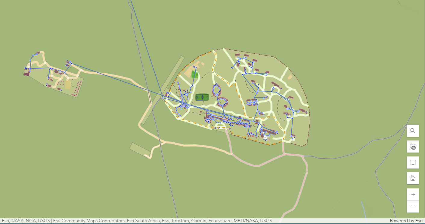
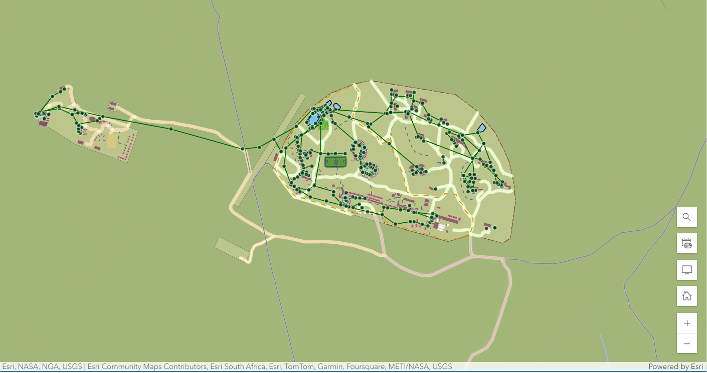
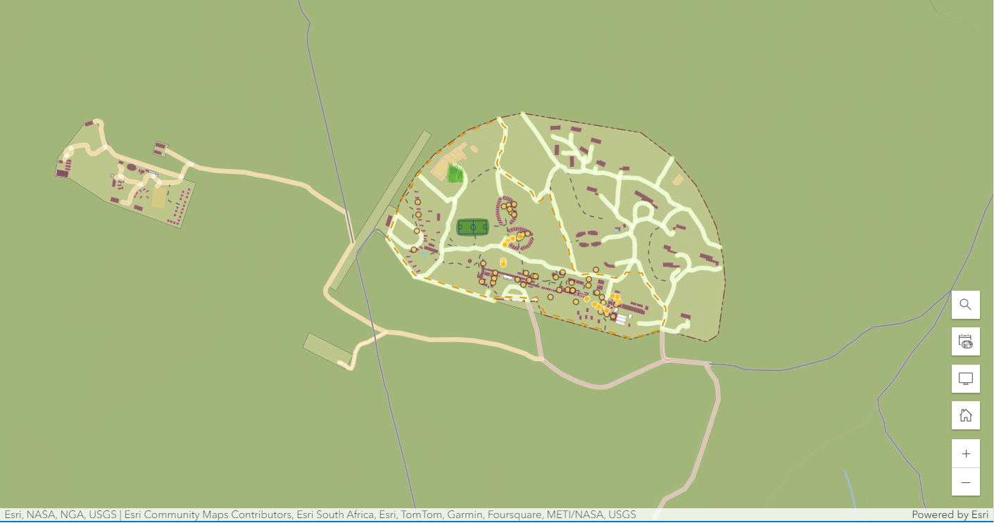
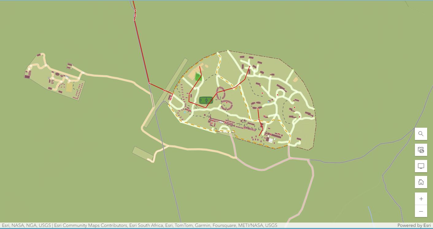
Above are static image versions of the Web Maps delivered for the college and are not interactive.
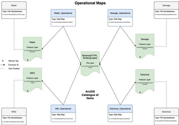
The Southern African Wildlife College requested Operational Maps be created so that the maintenance staff could easily access the relevant operational data. 4 maps were created that included water network data, sewage network data, electrical network data and Wi-Fi points on campus.
Data provided from the client was brought into ArcGIS Pro using the Fleming school license and the old geodatabase was sectioned off into the 4 different categories: Sewage, Wi-Fi, Water and Electrical. These categories and break down of data were confirmed from the client to be an accurate representation of which data should fall under the 4 categories.
Once the data layers were separated, the feature layers were added to their own geodatabase using ArcGIS Pro. These files were then zipped so they could be uploaded to AGOL.
Once uploaded to AGOL, feature layers were created for each file geodatabase. The database was designed in this way to ensure easier uploading to AGOL as the client will primarily be working off AGOL in the future. If in the future the client needs to bring this data offline, they would be able to download the file geodatabases from AGOL and be able to add this data to QGIS.
Four Web Maps were created to outline the appropriate data. These web maps featured the appropriate category of data, with the ability to turn on water, sewage and electrical networks. This was done for the staff to have easier access to data that could affect operations such as building new structures on campus or needing to dig below ground. They can easily flip between layers if needed, or keeping the four maps separate as well.